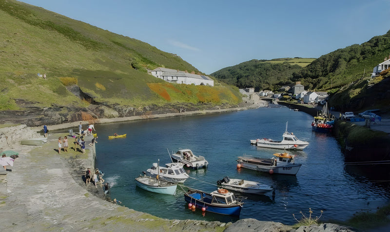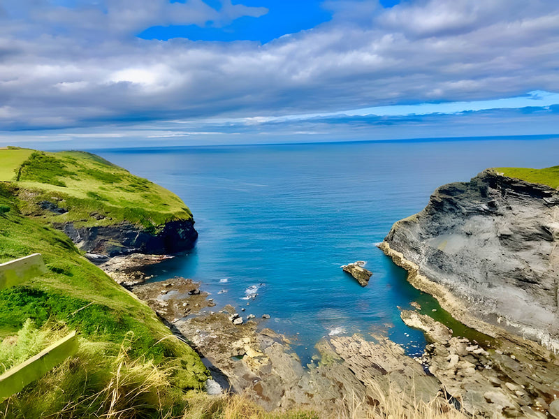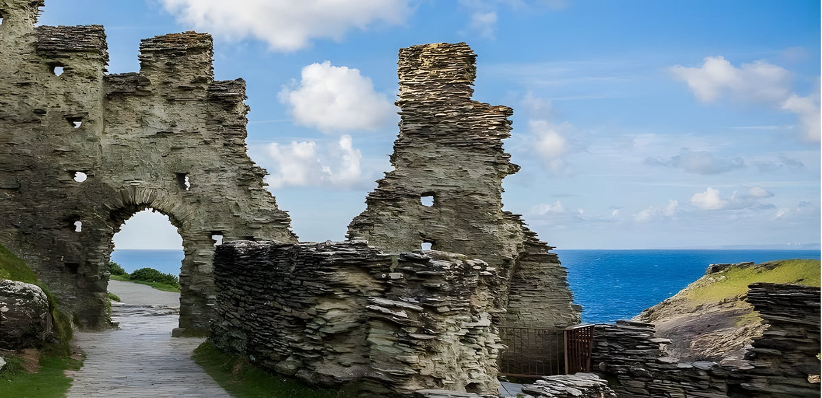
One of the classic coast path days in North Cornwall: from Boscastle harbour to Tintagel, with route notes and practical advice.
The coast path from Boscastle to Tintagel is one of the great walks of North Cornwall. In roughly five miles you pass high headlands, hidden coves, a wooded valley and a sandy beach, before arriving at the legendary castle ruins on Tintagel Island. It is a proper day out, with plenty of climbs, and it is a favourite with guests at Lower Pennycrocker Farm, about two miles from Boscastle.
This guide gives an overview. Carry an OS map (Explorer 111 covers the route) or a reliable walking app, and check conditions before you set off.
Walk at a glance
| Start | Boscastle harbour |
| Finish | Tintagel village or Tintagel Castle |
| Distance | Roughly 5 miles one way |
| Time | 3–4 hours walking, plus stops |
| Terrain | Coast path with steep climbs, steps and descents |
| Getting back | Bus (check seasonal timetables), taxi, or walk back |
The route
Boscastle to Willapark
From Boscastle harbour, cross to the south side and climb the coast path towards the white lookout tower on Willapark. The climb is steep but short, and the views back over the harbour are wonderful. Our Willapark lookout guide describes this headland.
Along the cliffs to Rocky Valley
Beyond Willapark, the path follows the clifftop south, dipping in and out of small valleys. Look out for the Forrabury Stitches inland, seabirds on the cliffs and seals in the water below.
Further on, the path drops into Rocky Valley, a narrow, rocky gorge where a stream tumbles down to the sea. It is one of the most atmospheric spots on this coast. Inland, paths lead up the valley towards St Nectan's Glen. Our St Nectan's Glen and Rocky Valley guide covers this area.
Bossiney
After Rocky Valley, the path continues past Bossiney, where steep steps lead down to Bossiney Haven, a sandy cove that is only accessible around low tide. See our Bossiney Haven guide.
Barras Nose and Tintagel
The final stretch takes you around the headland of Barras Nose, with views ahead to Tintagel Island and its castle ruins. Drop down into Tintagel Haven, where the castle entrance and the footbridge are, or head up into Tintagel village.
Tintagel Castle
Tintagel Castle is run by English Heritage. There is a charge for entry, and at busy times booking ahead is recommended. The footbridge across to the island, opened in 2019, is an attraction in its own right. Check opening times and ticket information on the English Heritage website before your walk, so you can plan your arrival. Our Tintagel page and Tintagel day trip post have more ideas.
Getting back
You have several options:
- Bus: buses link Tintagel and Boscastle, but services vary through the year. Check the latest timetable before you go.
- Taxi: book ahead, especially in summer.
- Walk back: fit walkers can return the same way, making a long day of about 10 miles.
- Two cars: leave one in Tintagel and one in Boscastle.
A good alternative is to drive to Tintagel, take the bus or a taxi to Boscastle, and walk back towards your car, so you are not watching the clock at the end.
How hard is it?
The path is well marked, but this is a strenuous walk. There are several steep climbs and descents, steps and exposed sections near unfenced cliff edges. It is suitable for fit walkers and older children used to hills. Allow plenty of time and take breaks.
What to bring
- Walking boots with good grip.
- Waterproof jacket and a warm layer.
- Plenty of water and snacks; there is nowhere to buy food between the villages.
- Sun cream and a hat.
- Phone, map and some cash for the bus.
Safety
- Stay on the path, especially near cliff edges.
- Keep dogs on a lead near the cliffs and livestock.
- Check the weather; avoid the walk in strong winds or fog.
- If someone is in trouble on the cliffs or at sea, call 999 and ask for the coastguard.
Walking from the campsite
The coast path is about half a mile from Lower Pennycrocker Farm, north of Boscastle. Keen walkers can walk from the campsite to Boscastle along the coast and then continue to Tintagel, making a long but rewarding day. Our coast path from Pennycrocker post explains how to reach the path.
Lunch ideas
There are no cafés on the path itself, so most walkers pack a picnic and stop on a quiet headland or above Rocky Valley. Tintagel village has plenty of cafés, pubs and bakeries for a late lunch or a pasty at the end. If you prefer a sit-down meal before you set off, Boscastle has good options. See our places to eat in Boscastle.
Best time to walk
Spring and early summer bring wildflowers on the cliffs. September is often settled and quieter. Avoid the hottest part of summer days, as there is little shade.
Frequently asked questions
How far is it from Boscastle to Tintagel on the coast path?
Roughly five miles one way.
How long does it take?
Most walkers take 3–4 hours, plus stops.
Is there a bus back from Tintagel to Boscastle?
Buses link the two villages, but timetables change through the year. Check before you set out.
Is the walk suitable for children?
It suits older children who are used to hills. Keep them close near the cliffs.
Prefer to leave the car behind? See car-free days out from Boscastle by bus.
Stay near Boscastle
Lower Pennycrocker Farm is a quiet, family-run campsite at St Juliot, about two miles from Boscastle (PL35 0BY). We welcome tents, touring caravans, motorhomes and campervans from 1 April to 31 October. Adults are £10 a night, children aged 5 and over £5, electric hook-up £7 and dogs £2 each (maximum two). Showers are free and you park beside your pitch. Check availability and book direct, or see pitches and prices.